projects
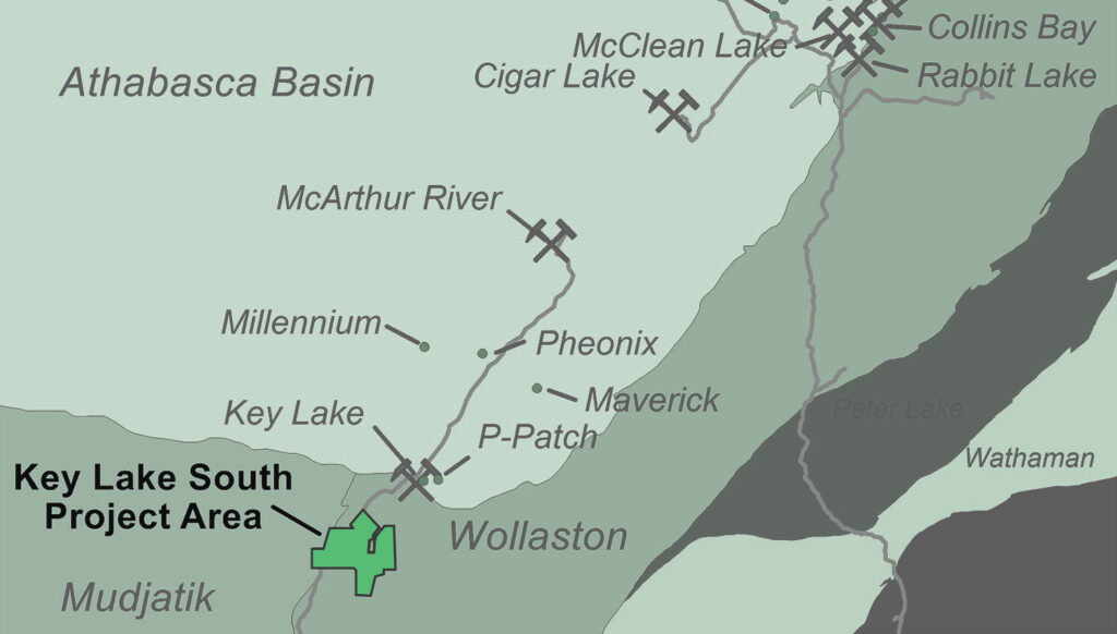
Key Lake South
project description
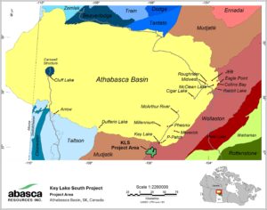
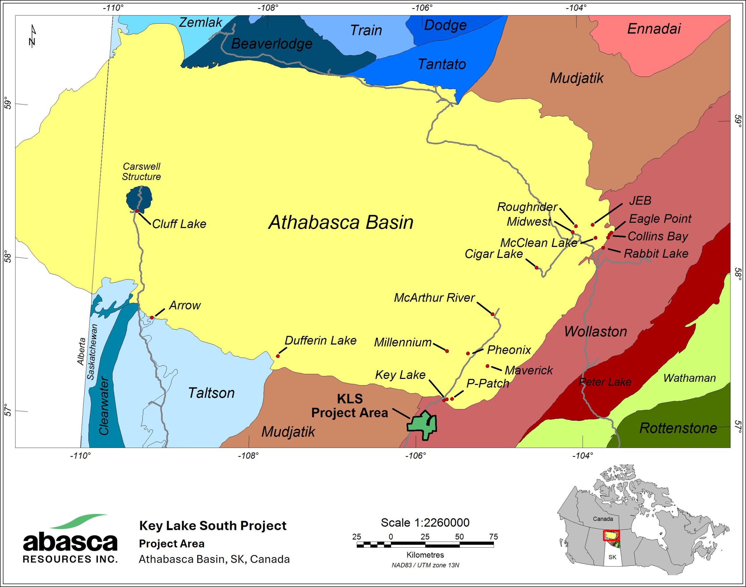
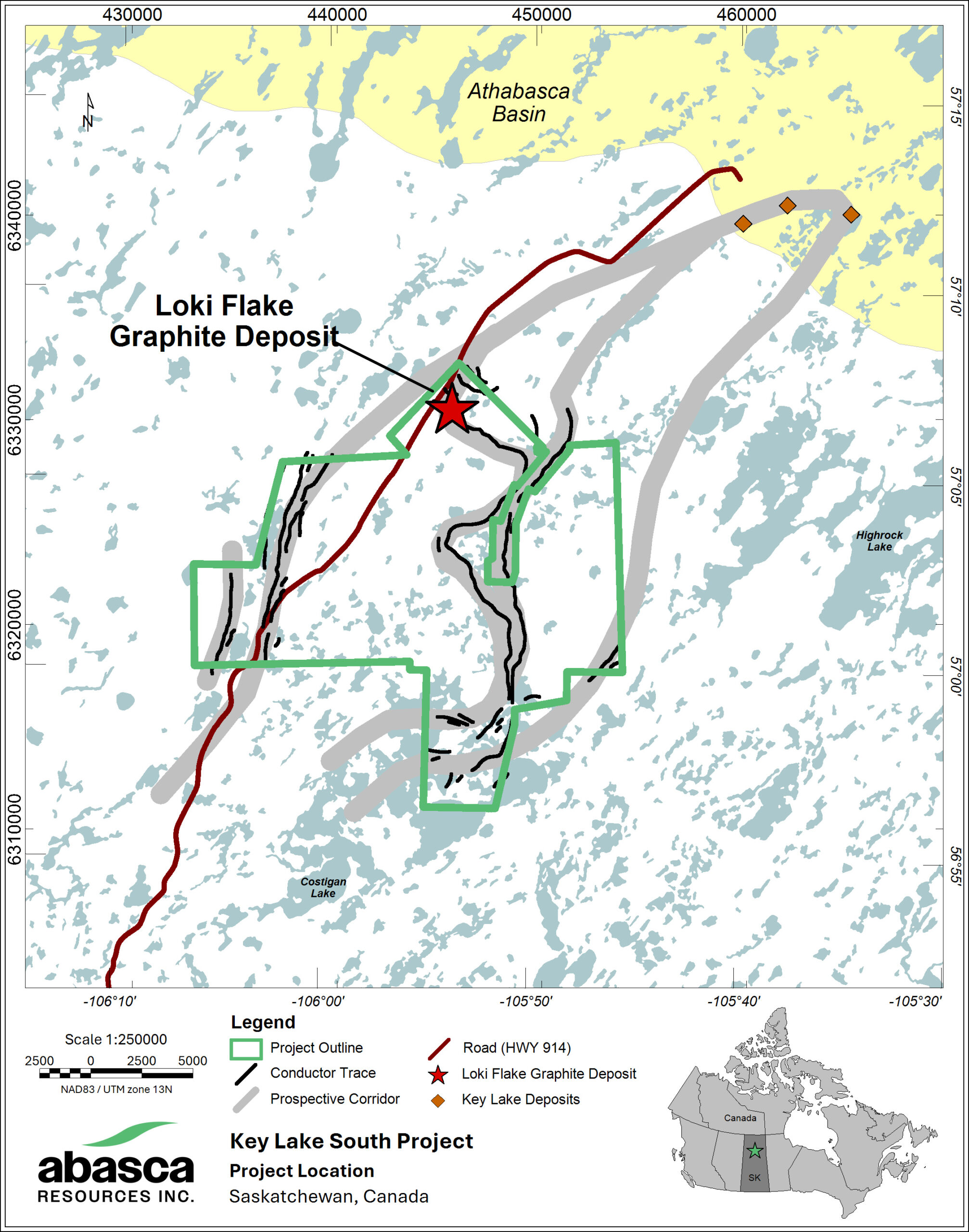
The Key Lake South Project (KLS) is located approximately 15 kilometres south of the Key Lake mill which processes ore from Cameco Corp.’s (TSX: CCO; NYSE: CCJ) McArthur River uranium mine. Provincial Highway 914, a north-south all-weather highway in Saskatchewan, crosses the project, providing ideal access. The project consists of 12 contiguous claims (23,974 hectares or approximately 240 sq. km) which were staked during 2011 to 2012 and have been held and explored by a private company (“SaskCo”) until the end of 2022. The project was then transferred to Abasca Resources Inc. by reverse takeover of a TSX Venture listed corporation and is 100%-owned.
KLS is underlain by the prospective uranium hosting rocks of the Wollaston-Mudjatik contacting zone (WMCZ) in the southeastern Athabasca Basin. The world’s largest high-grade uranium deposits are associated with the unconformity between the Athabasca Basin and the Wollaston-Mudjatik basement. Most of the uranium occurrences and deposits associated with the Athabasca Basin are located near the boundary between the Mudjatik and Wollaston domains as either unconformity-related or basement-hosted type. KLS is located in the southern strike extent of these deposits and in the same regional magnetic low structure that hosts them. Alteration at the KLS shows characteristics of both unconformity-type and basement-hosted deposits.
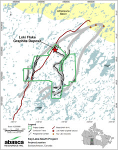
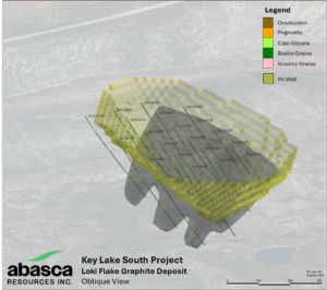
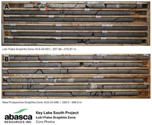
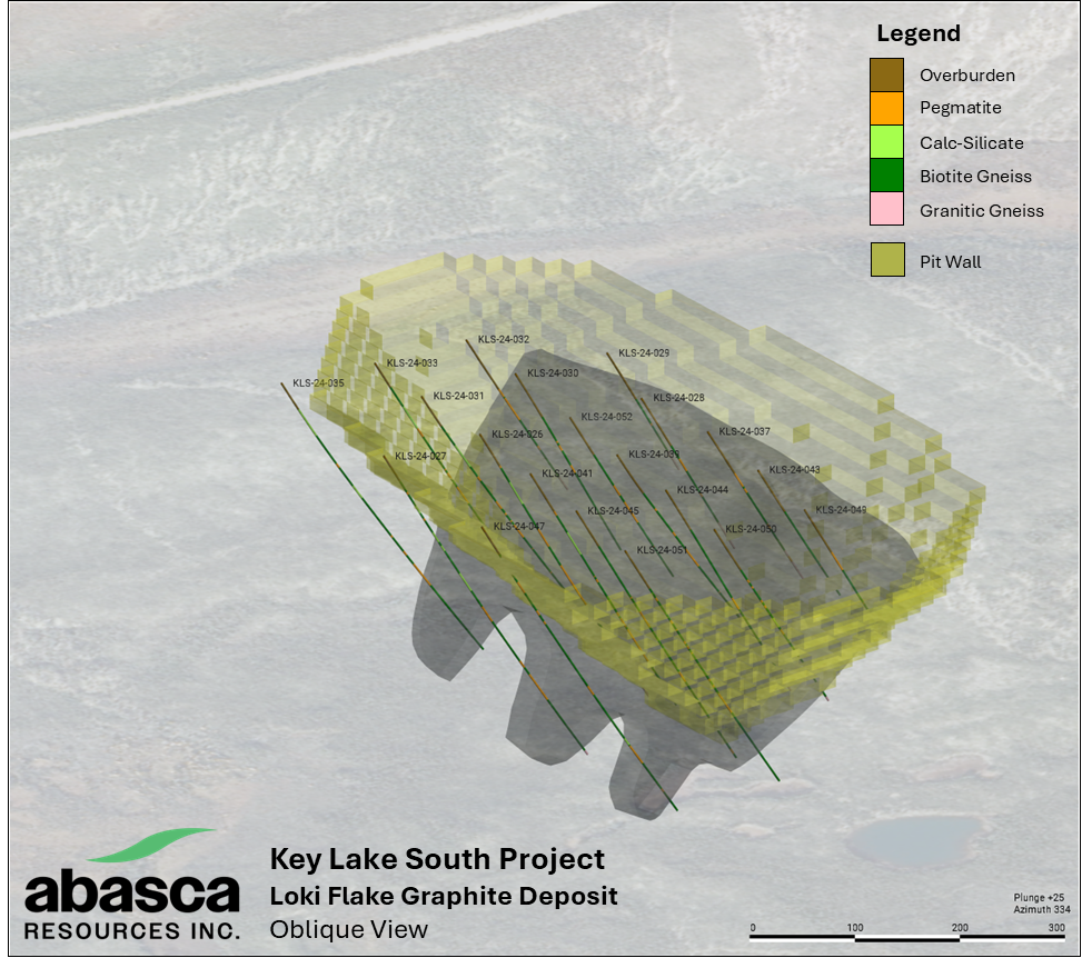
In addition to the uranium prospectivity, KLS also hosts the Loki Flake Graphite Deposit (“Loki Deposit”) in the northern part of the project area. The Loki Deposit was discovered by Abasca in 2016 while exploring for uranium at KLS and representative drill core samples were taken of the zone for the purpose of uranium exploration. The 2016 drilling intersected the zone over a 2 km trend with intersections up to 40 m in length. In the fall of 2023, the samples were re-analysed for graphite and assays returned values up to 22.2 Cg %. A subset of the samples was also selected to determine the graphite flake size distribution by QEMSCAN, which yielded a median passing percent up to 214 μm.
Highlights
23,974
Size in hectares
> 48,000
Total Meters Drilled
100%
Owned
recent exploration
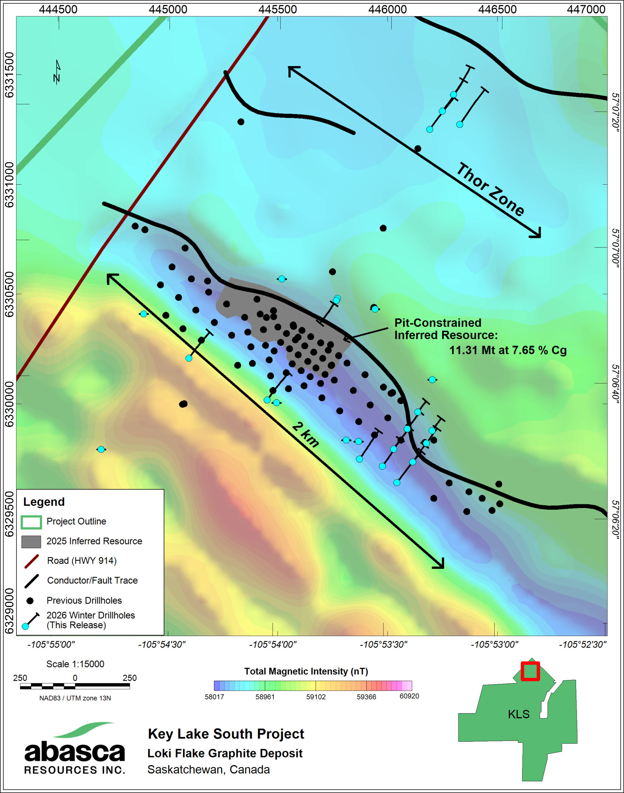
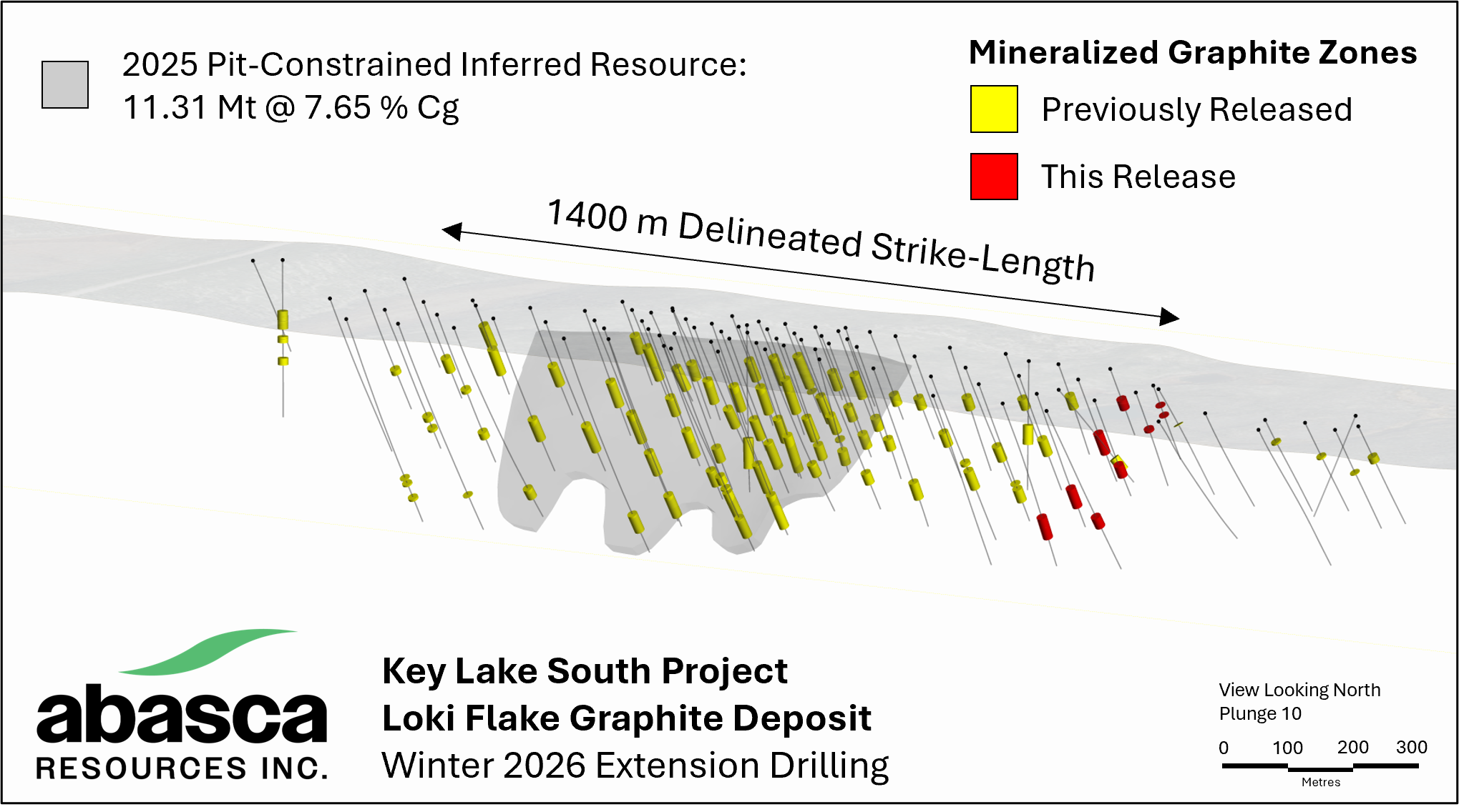
In the winter of of 2026, a total of 4,922 m of drilling was completed – 4,517 m over 18 diamond drillholes and 405 m over 12 sonic drillholes. The drilling focused on three objectives: 1) continued extension of the Loki Deposit toward the southeast at 100 x 100 m grid-spacing, 2) geotechnical and hydrogeological drilling, and 3) exploration drilling at the Thor Zone.
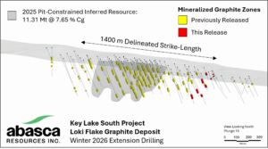
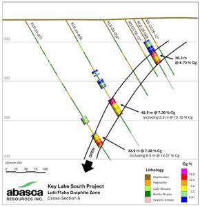
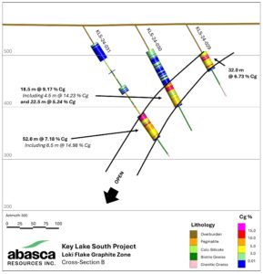
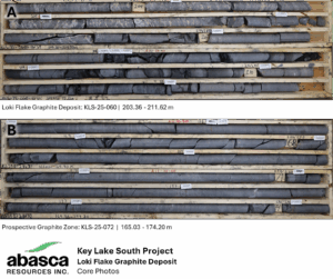
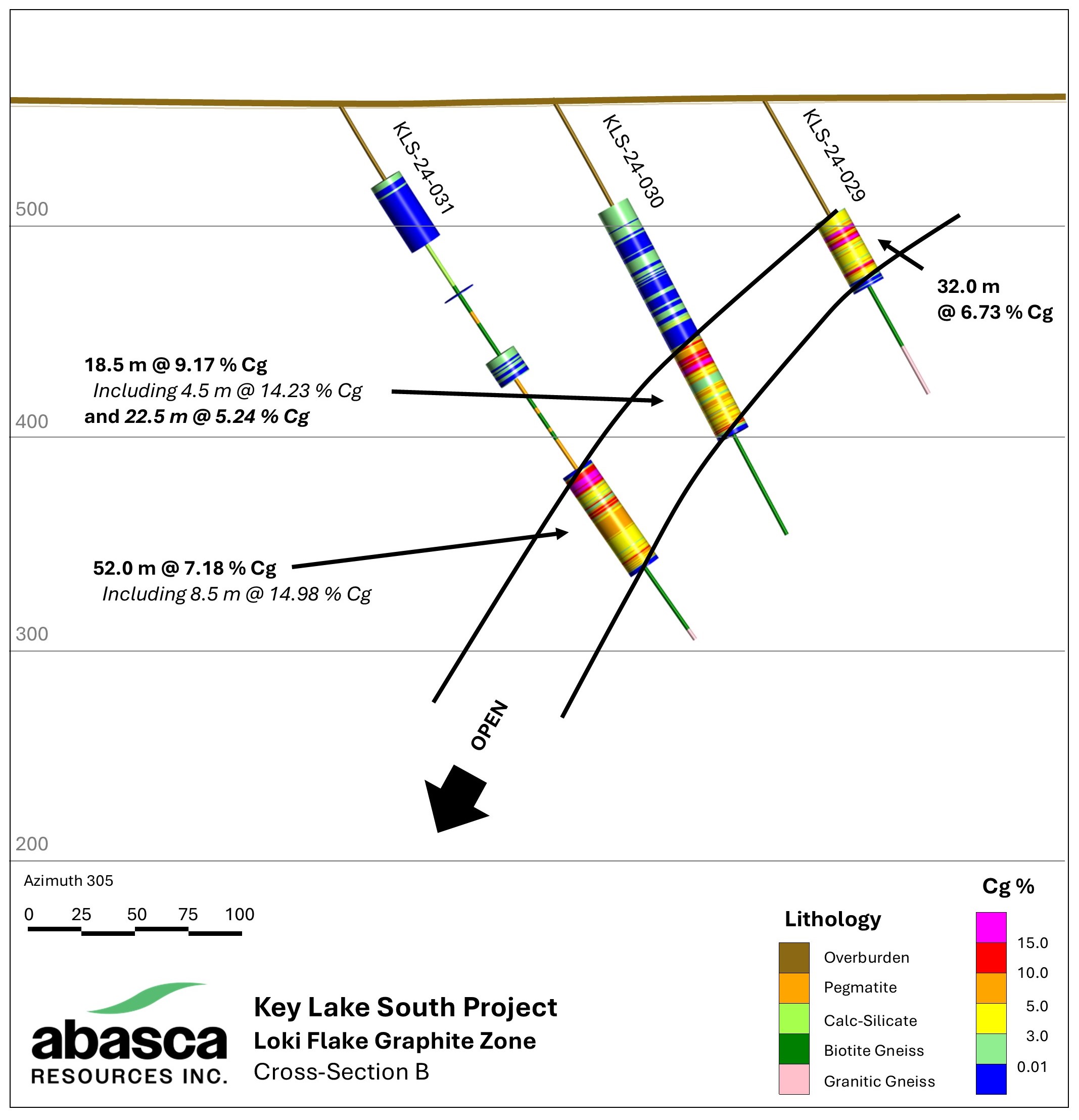
A total of 8 drillholes were completed over two fences to extend the delineation of the Loki Deposit by 200 m of strike-length (Figure 2 and Figure 3). The drilling was designed to verify the folded EM-conductor interpretation and support geotechnical work. Moderate graphite mineralization was intersected, and the zone remains open down-dip. Drillhole locations and assay results for these drillholes are shown in Tables 1 and 2, respectively.
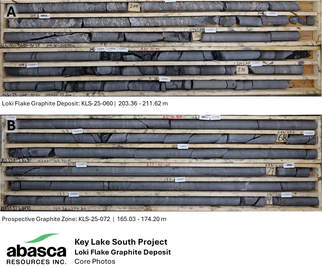
An additional 4 drillholes were completed at the Thor Zone which focused on testing the up-dip continuation of the two graphitic zones identified in KLS-25-072. The drilling at the Thor Zone intersected graphitic zones similar to those intersected in the previous drilling program. Assay results for these drillholes are pending.
Geotechnical and hydrogeological drilling was successfully completed and will be incorporated into project studies to further investigate the Loki Deposit’s resource quality and support the environmental baseline study along with other wild animal and aquatic data collection. Assay results for these drillholes are pending.
loki flake graphite deposit
NI 43-101 Technical Report (PDF)
The Loki Deposit was discovered by Abasca in 2016 while exploring for uranium at KLS and representative drill core samples were taken of the zone for the purpose of uranium exploration. The 2016 drilling intersected the zone over a 2 km trend with intersections up to 40 m in length. In the fall of 2023, the samples were re-analysed for graphite and assays returned values up to 22.2 Cg %. A subset of the samples was also selected to determine the graphite flake size distribution by QEMSCAN, which yielded a median passing percent up to 214 μm.
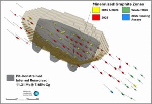
In 2024, 20 holes totaling 5,499 m, were drilled into a 600 m section of the Loki Flake Graphite Deposit at 100 m drill spacing. These holes, as well as re-sampled holes from the 2016 drilling, contributed to the maiden graphite resource announced on April 15, 2025. The Mineral Resource Estimate (Table 1) includes:
- Total Inferred Resource: 11.31 Mt of Graphite at and average grade of 7.65 % Cg.
- Contained Graphite: 0.86 Mt
- Cut-off Grade: 2.78 % Cg
Table 1: Pit-constrained inferred mineral resource estimate of the Loki Flake Graphite Deposit.
| Category | Cut-off Grade (% Cg) | Tonnage (Mt) | Grade (% Cg) | Contained Graphite (Mt) |
| Inferred | 2.78 | 11.31 | 7.65 | 0.86 |
- The reporting standard for the Mineral Resource Estimate uses the terminology, definitions and guidelines given in the Canadian Institute of Mining, Metallurgy and Petroleum (CIM) Standards on Mineral Resources and Mineral Reserves (May 2014) as required by NI 43-101.
- Reported Mineral Resources are constrained to a pit-shell generated in Whittle software above a cut-off grade of 2.78 % Cg.
- The estimation of Mineral Resources was completed through a block model approach using interpreted geology wireframes, composites from drill core assays, and grade interpolation via Ordinary Kriging.
- Numbers may not add up due to rounding.
- The effective date of this Mineral Resource estimate is April 10, 2025.
- The qualified person knows of no environmental, permitting, legal, title, taxation, socio-economic, marketing, political or other relevant factors that may materially affect the Mineral Resource Estimate in this report.
- Mineral Resources are not Mineral Reserves and have not demonstrated economic viability.
The Loki Deposit is hosted in the metapelitic rocks of the Wollaston Domain along a northwest-trending fault zone with graphite mineralization extending from the overburden-basement contact down-dip toward the southwest. Calc-silicate and pegmatite rocks are intersected in the hanging wall, interlayered with the metapelitic rocks, which are all structurally overlying granitic gneiss.
Continued delineation at the Loki Deposit was completed over two drill programs in 2025, comprising 51 diamond drill holes for a total of 11,950 m. The programs focused on extending the 2024 delineated zone at 100 m grid-spacing as well as in-fill drilling of the 2024 drilling area. The programs successfully delineated the extension along strike by 300 m toward the northwest and 400 m toward the southeast. Highlighted intercepts include 10.11 % Cg over 49.7 m (KLS-25-101) and 9.49 % Cg over 56 m (KLS-25-097).
The Loki Deposit remains open at depth and along strike.
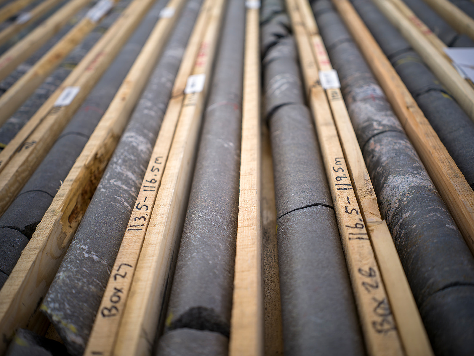
Collected samples were sent to SRC Geoanalytical Laboratories in Saskatoon, Saskatchewan, an independent laboratory accredited under ISO/IEC 17025:2017, for preparation and ICP-MS multi-element analysis, boron by fusion as well as total graphite content (% Cg) and total sulphur by LECO. Samples were collected in accordance with industry-standard quality assurance / quality control practices and included the insertion of blanks, standard reference materials, and repeats into the sample stream at regular intervals. Samples were also collected for in-field and lab density measurements at regular intervals and through the mineralized zones.
thor zone
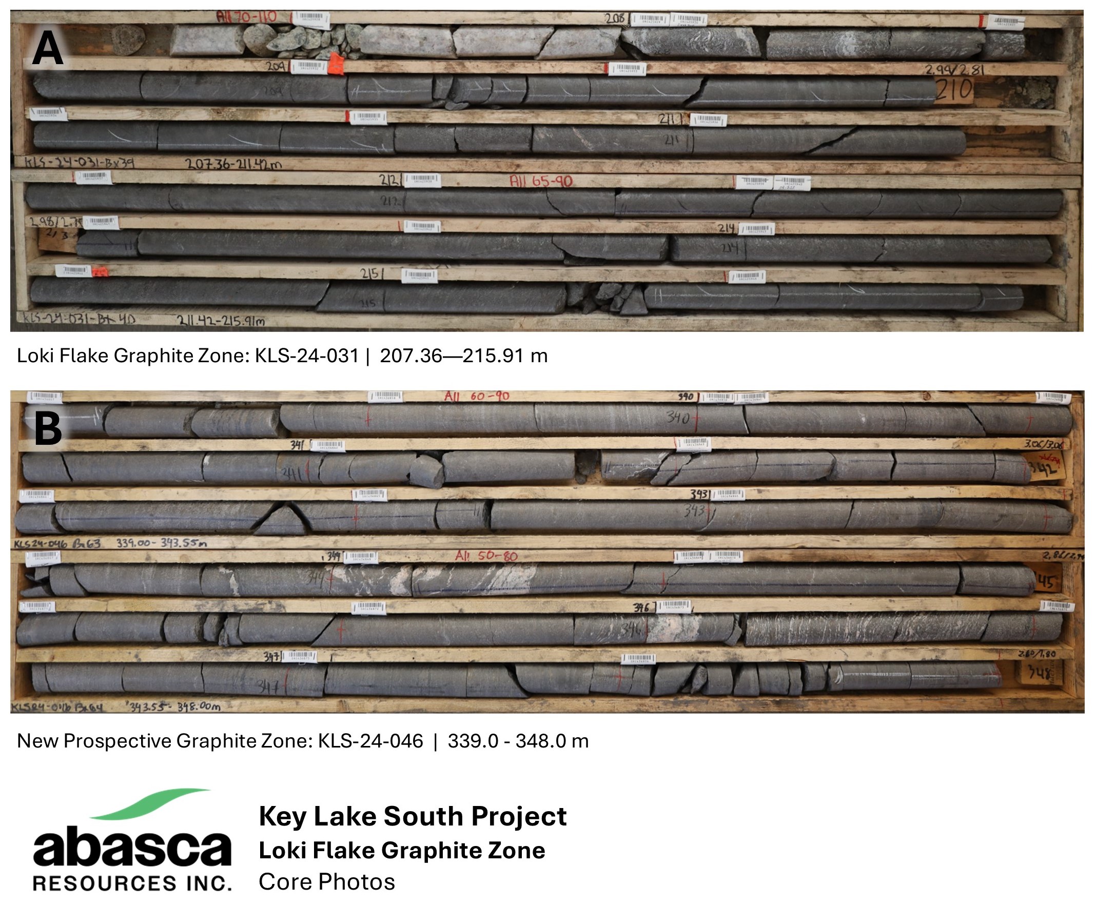
During the 2024 summer drill program, 2 holes, totaling 912 m, were drilled on a parallel conductor north of the Loki Deposit. These holes intersected a new graphite zone that was up to 50 m wide – now referred to as the Thor Zone. This includes a highlighted intercept in KLS-24-046 (8.91 % Cg over 27 m). An additional diamond drill hole (KLS-25-072) totalling 429 m was drilled at the Thor Zone 400 m up-dip from KLS-24-046, where 72 m of graphite mineralization was intersected over 3 zones. Highlights from KLS-25-072 include 7.36 % Cg over 8 m, 9.78 % Cg over 32 m, and 6.39 % Cg over 32 m.
The Thor Zone remains open in all directions.
project history
Considerable exploration activity by multiple operators has occurred on the KLS Project. Early regional exploration activities between the late 60s and throughout the 70s focused on ground prospecting, lake water geochemistry, and airborne radiometric and electromagnetic (EM) surveys as well as some shallow drilling. Although these early activities led to the discovery of the nearby Gaertner and Deilmann deposits that comprise Key Lake, no significant uranium mineralization was discovered over the current KLS Project area during that time. During the early 80s, anomalous radioactivity in pegmatites was discovered during ground prospecting surveys over the KLS Project area and shallow follow-up drilling was done during the mid-2000s with limited technical success.
SaskCo acquired ownership of the property through staking in 2011 and 2012. Various compilation reports and interpretations of historical data were undertaken by SaskCo, both in-house and by independent consultants, in 2011, 2012, and 2013, resulting in identifying target areas and recommendations for future exploration work. Field programs, including airborne and ground geophysical surveys, geological mapping, soil and lake sediment geochemical surveys, and radon-soil-surveys were conducted by SaskCo in 2014 and 2015.
In 2016, SaskCo carried out a diamond drilling program to test geological features interpreted by the previous exploration data, including the 2014 HeliFALCON Airborne Gravity Gradiometer survey, EM surveys, geochemistry surveys, and geological mapping. A total of 4,553 metres were drilled comprising 26 NQ holes in two target areas: 15 holes totalling 2,744 metres in the Campbell Creek area and 11 holes totalling 1,809 metres in the Mustang area where SaskCo discovered intersections of up to 256 ppm U over 0.4 m. In 2022, Condor Consulting Inc. was engaged in further interpreting and modelling available geophysical survey data to assist with SaskCo’s in-house technical team for structural analysis, target prioritizing, and detailed drillhole planning.
In 2023, Abasca completed an additional 25 holes totaling 10,135 m over winter and summer drill programs at KLS. Geochemical assays confirmed anomalous uranium intersections at the Mustang target area where 9 of the 11 drillholes intersected anomalous uranium over a cumulative total core length of 13.85 m. KLS-23-004 intersected a total of 1.5 m of anomalous uranium, including 10 cm at 1260 ppm U and KLS-23-006 intersected a total of 3.4 m of anomalous uranium, including 79 cm at 897 ppm U and 43 cm at 942 ppm U. KLS-23-009 intersected a total of 2.4 m of anomalous uranium, including 50 cm at 1010 ppm U.
Multiple holes in the 2023 drilling included intersections of stacked graphic fault zones with overprinting fracture zones, fault gouge, and local fault breccia – ideal features in other basement-hosted uranium deposits in the Athabasca Basin region. Silicification, hematite and clay alteration observed in drillholes within and proximal to fracture and fault zones. The identification of the alteration within reactivated fault zone systems and coincident anomalous pathfinder element geochemistry, including Boron, Cerium and Copper, is essential to the search for uranium deposits.
In 2024, 27 holes were drilled at KLS, totaling 9,092 m. Drilling was divided between regional exploration along the Seager Lake trend (“Seager Trend”) on the western side of the property and the Loki Flake Graphite Deposit. A total of 5 holes were drilled along the Seager Trend, totaling 2,681 m. Drilling intersected pervasive silicification zones and local graphitic fault zones.
Subsequent work at KLS has been focused on delineating and advancing the Loki Flake Graphite Deposit and exploration of the Thor Zone.
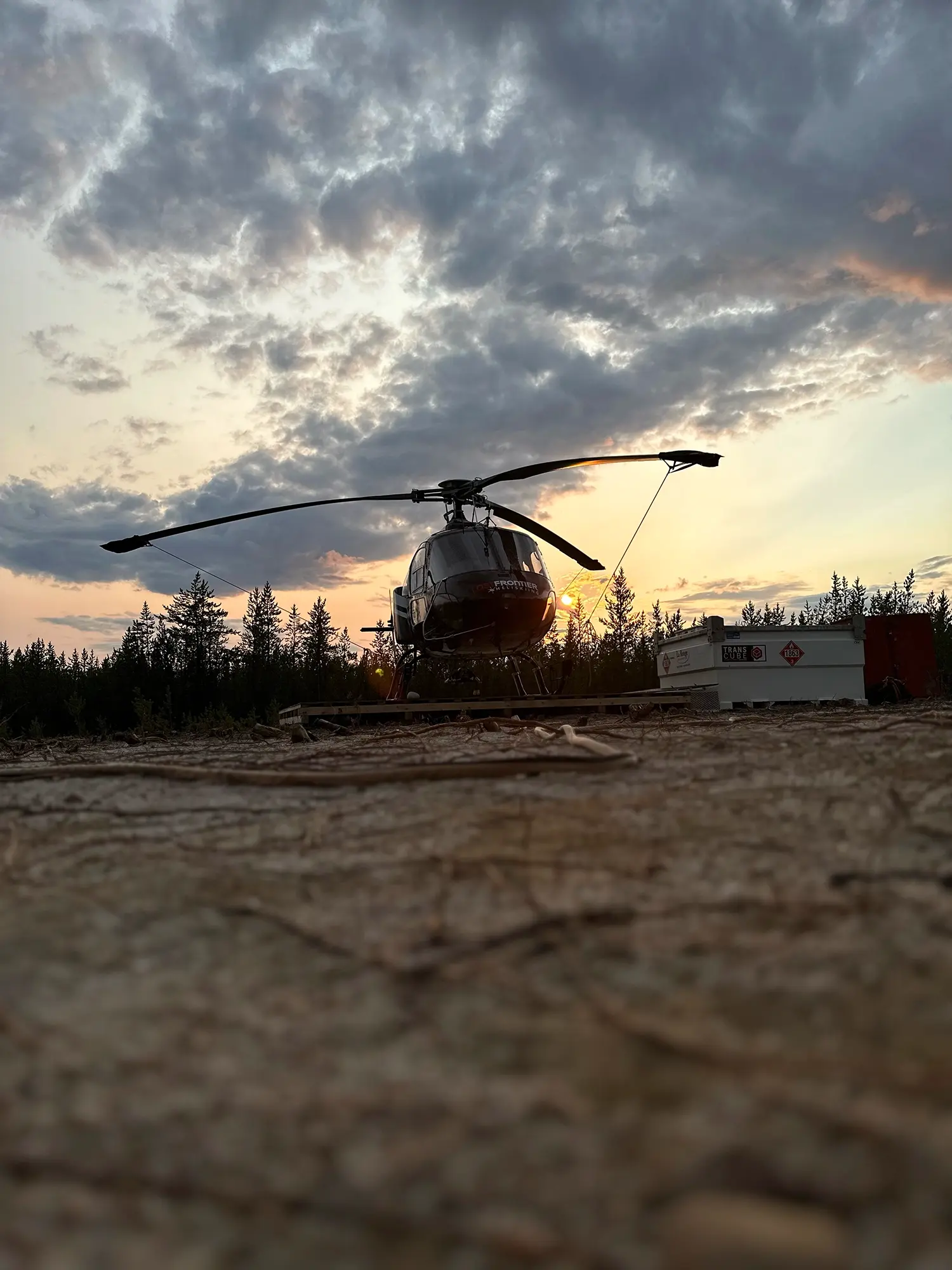
gallery